Welcome to this Helsinki climate guide! As the capital of Finland, Helsinki features a climate characterized by cold winters and mild summers. In this article, we will examine the geographical factors shaping Helsinki’s climate, discuss the typical weather you can expect, delve into seasonal variations, and explore extreme conditions. We will also briefly touch on how Helsinki’s climate is and will continue to be affected by climate change.
Data and content are input by the author, who also provides a detailed framework for the post. AI writing tools assist in generating the content, but the author carefully reviews and edits the text to ensure quality and accuracy. Website’s terms and conditions apply.
The climate of Helsinki: A humid continental climate
Situated in the south of Finland, Helsinki is located at a latitude of 60.2 degrees North and 24.9 degrees East, on a peninsula that extends into the Gulf of Finland, causing the city to be largely surrounded by water. To the north, Finland’s capital is connected to an extensive landmass spanning hundreds of kilometres.
The enormous landmasses to the north and nearby to the east, the city’s relatively high northern latitude, and the moderating effects of the Gulf of Finland, Baltic Sea, and warm Gulf Stream west of Scandinavia, along with predominantly westerly winds, all play a role in shaping Helsinki’s climate. As a result, the city experiences a humid continental climate (Köppen climate classification: Dfb1), leading to a climate with large seasonal differences. The summers are warm, while the winters are cold, with relatively high humidity throughout the year.
Typical weather in Helsinki
Helsinki generally experiences cool to cold weather, with relatively warm summer months. Based on the climatology of 1991-2020, the yearly average daily maximum temperature is 9.6 degrees Celsius. July is the warmest month, with an average daily maximum temperature of 21.9 degrees, while February is the coldest, featuring a mean daily maximum temperature of -1.3 and a mean daily minimum temperature of -6.3 degrees.
Temperatures drop below freezing on approximately 118 days per year, with frost possible from October to May. Ice days, or days when the temperature remains below freezing, total around 48 days annually. Although temperatures can occasionally plummet to -20 degrees, such extremes are usually limited to a few days each winter. Warm days, with maximum temperatures above 20 degrees, average 54 days per year, mostly occurring between May and early September. During warmer days in late spring and early summer, an afternoon sea breeze is common.
Precipitation is relatively even throughout the year, though spring is typically the driest season. The total yearly precipitation amounts to 653 mm, while the number of days with significant precipitation (≥ 1 mm) reaches 110. In autumn and winter, frontal systems primarily cause precipitation, while summer precipitation is often linked to showers or thunderstorms. As a result, summer precipitation tends to be shorter in duration but more intense. Snowfall can occur from late October to April, while an actual snow cover can form between November and early April.
Here’s a climate table summarizing the average temperatures and precipitation throughout the year in Helsinki:

Data source: FMI. Colourmaps: Crameri2. All data except for ‘Amount of Sunshine’ comes from Helsinki Kaisaniemi weather station. Data for ‘Amount of Sunshine’ comes from Helsinki Kumpula weather station.
Seasonal variation in Helsinki: what to expect throughout the year
Helsinki knows four distinct seasons, with relatively large differences in the typical weather between them.
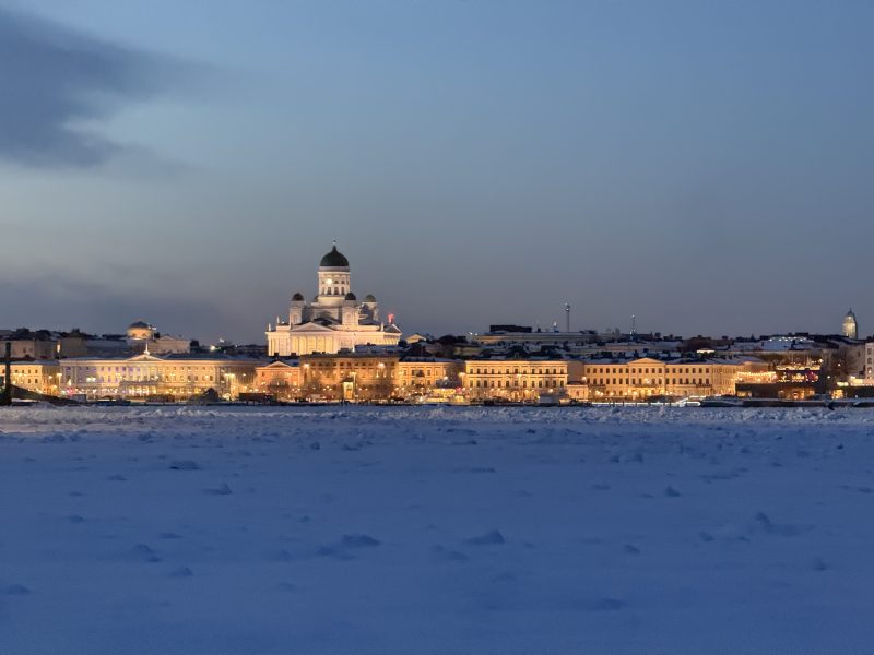
Helsinki winter climate (December-February): dark, cold and snowy
In part due to the very short daylight period – in most of December, the daylight period is less than 6 hours – winters in Helsinki are characterized by cold and dark weather. Most days see temperatures dip below freezing, and on nearly half of the winter days, even the maximum temperature remains below freezing. Precipitation is common, and the weather is often cloudy. Although most winter precipitation falls as snow, rain and sleet can also occur. Helsinki is typically snow-covered during the majority of winter, but the number of snow cover days has decreased over recent decades.
Occasionally, during the coldest periods, the temperature can drop below -20°C. During these cold periods, even maximum temperatures can remain well below -10°C. Yet, winters in Helsinki are less cold than in most of Finland, thanks to the moderating influence of the Gulf of Finland. In cold winters, the Gulf of Finland might partially freeze over. This is however becoming increasingly rare.
Cold weather regularly goes hand in hand with clear weather, whereas milder days are often associated with fog and drizzle or other kinds of precipitation. Due to Helsinki’s location close to the coast, it can be windy. This can significantly impact the wind chill temperatures, and for this reason grey, windy days with temperatures just a few degrees below 0 can feel colder than the coldest winter days that occur in very calm conditions.
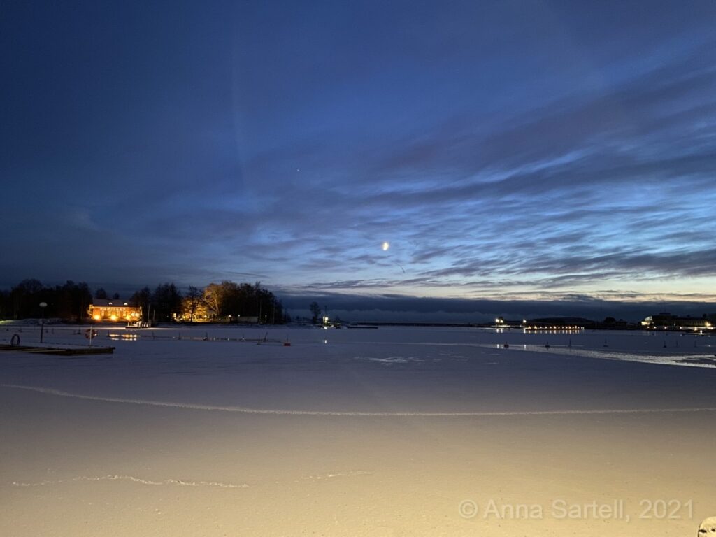
Winters in Helsinki are generally long. In the coldest winters, the Gulf of Finland partially freezes over, like in the photo above. In the past century, sea ice along the coast of Helsinki was the norm in wintertime. Nowadays, sea ice in winter is not a given anymore. In 2021, the winter started off very cold, and sea ice already formed in December.
Helsinki spring climate (March-May): melting snow and rising temperatures
As the winter snow melts, Helsinki transitions into spring. During this time of year the length of daylight rapidly increase and the temperatures gradually rise. The daily maximum temperatures generally range from 1 to 15 degrees, but frost is still common, especially during the nights and early morning.
Specifically March and early April remain relatively cold, with frost (even ice days), snowfall, and snow cover still common. People that are used to warmer climates might perceive March as a winter month. By the 2nd half of spring, the city really starts to come alive with the blossoming of plants and trees. May typically marks the first time temperatures rise above 20 degrees.
Spring is the driest season in Helsinki, with precipitation totaling around only 100 mm over these three months. Sunny weather is common, particularly later in spring. The sunshine duration is especially high in May, but this is partly thanks to the long daylight period this time of year.
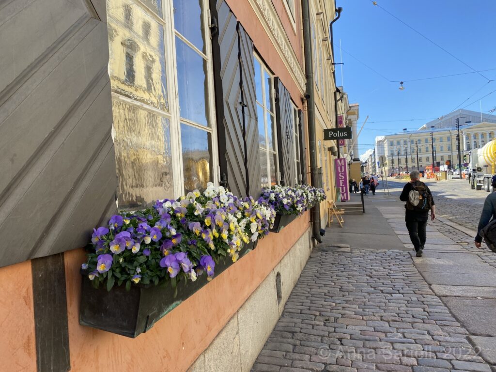
It takes a while for spring in Helsinki to get nice and warm, but especially in the 2nd half of spring, the weather can be beautiful.
Helsinki summer climate (June-August): long, warm days
Summer is the warmest and sunniest season in Helsinki, not in the last place thanks to the long days. In mid to late June, the sun rises around 4 AM and sets just before 11 PM, resulting in a total of 19 daylight hours. Maximum temperatures generally range between 18°C and 25°C, with July and August being the warmest month. Most days see temperatures exceed 20°C and occasionally the temperature can surpass 25°C. In some summers, temperatures might exceed 30°C, however this is not very common. The cooling effect of the Gulf of Finland keeps summer temperatures in Helsinki lower than in areas further inland.
While precipitation duration in summer is generally short, the average amount of precipitation is similar to that in fall. Warmer weather creates a more unstable atmosphere, leading to rain showers and occasional thunder and hailstorms. The showers most frequently occur in the (late) afternoon or evening.

Mild warmth, abundant sunshine, followed by developing cumulus clouds and the occasional afternoon shower—a typical Helsinki summer day.
Helsinki autumn climate (September-November): cooling temperatures and increasing rainfall
Autumn in Helsinki is marked by rapidly decreasing daylight length and cooling temperatures; the average highs decrease from 15°C in September to around 5°C in November. While September can still occasionally – specifically in the beginning of the month – produce a summer-like day with high temperatures and lots of sunshine, the first snow can fall as early as halfway October.
The fall is often characterized by grey and rainy weather. In September, summer-like showers and thunderstorms are still possible, partly due to the now relatively warm Gulf of Finland. Later in fall, the precipitation is mostly caused by frontal systems, with the proximity of the sea enhancing the amount of precipitation.
The first frost typically occurs in October, while November often marks the beginning of significant wintery conditions with frost, ice days, and sometimes substantial snowfall.
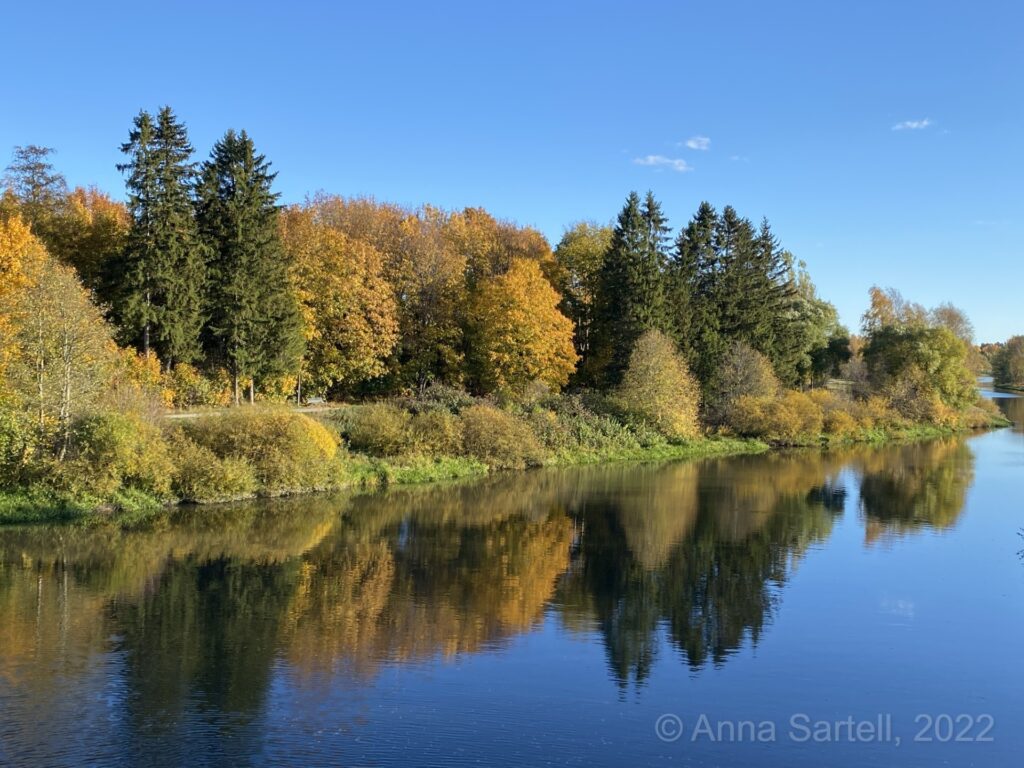
While fall in Helsinki is often rainy and grey, the season’s best days offer vibrant colors and stunning views, as seen here along the Vantaa River.
Weather extremes in Helsinki
Weather extremes in terms of temperature are less likely in Helsinki than in other regions of Finland, thanks to the moderating effect of the sea. Based on the 1991-2020 climate statistics, the lowest average yearly temperature is -20.6°C, while the highest yearly temperature is around 28°C. Further inland, this temperature range is significantly greater. Even within Helsinki itself, temperature differences can be substantial. For example, the Helsinki-Vantaa Airport – located only 15 km north (inland) of the city center – generally experiences lower temperatures in winter time, while measuring higher temperatures in summer.
During warm summer days, maximum temperatures in the city center are often slightly lower than those further inland, while nighttime temperatures are higher. The urban heat island effect contributes to higher winter and nighttime temperatures. Differences in snow depth between Helsinki’s city center and its airport can reach tens of centimeters, with the latter location usually having deeper snow.
The lowest temperature ever (reliably) recorded in Helsinki was -34.3 on the 10th of January, 1987. Temperatures as low as -30°C can only occur when the Gulf of Finland is frozen over, something that rarely happens nowadays. The highest temperature ever recorded was 33.2 on the 28th of July 2019.
Severe weather is Helsinki is generally limited to occasional extreme thunderstorms in summer, windstorms in the fall and snowstorms in winter. Some winters may see snow events that result in several decimetres of snow in one or several day(s). Flash floods can occur in summer or early fall, but are rare.
The highest snow depth ever measured in Helsinki is 89 cm, a record set in 1966. Since the beginning of modern measurements, the highest amount of precipitation recorded in a single day is 73.3 mm on the 24th of July 1993.
Climate change in Helsinki: a warmer and wetter city?
Helsinki has been warming rapidly over recent decades, both as consequence of anthropogenic climate change as well as the expansion of the city, increasing the urban heat island effect. This warming trend is evident in the weather statistics: cold extremes are becoming less frequent, while warm extremes are occurring more regularly. The amount of precipitation is increasing in both winter and summer. This has two reasons: warmer air can hold more water vapor, and more evaporation takes places over the warming Baltic Sea and Gulf of Finland, both phenomena leading to a higher availability of moisture in the atmosphere.
The number of days with a snow cover is decreasing; precipitation in winter more often falls as rain. However, when it does snow, the amount of snow that falls during a single snowfall event can be much larger due to the increased amount of moisture in the atmosphere.
The trends over the last decades are expected to continue in the future; in the next decades Helsinki will continue to warm, precipitation amounts will increase, and the snow season will become shorter. The extent and pace of these changes depend on how quickly greenhouse gas emissions are reduced.
Read more:
What is climate & climatology?
Climate info for geographical regions
References: